
CLEVELAND — It’s been a relatively cool spring with a few hot days mixed in.
But that’s all about to change as summer officially arrives with a stretch of soaring heat around Northeast Ohio and much of the eastern U.S.
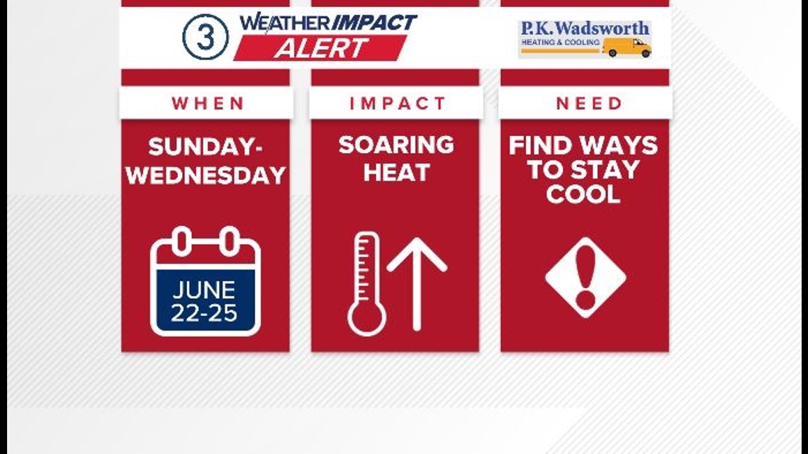
As a result, we have Weather Impact Alerts of the dangerous heat we’re expecting for Sunday, Monday, Tuesday and potentially Wednesday next week.
RELATED: FORECAST | See the extended 7-day outlook for Northeast Ohio

It’s summer and it gets hot.
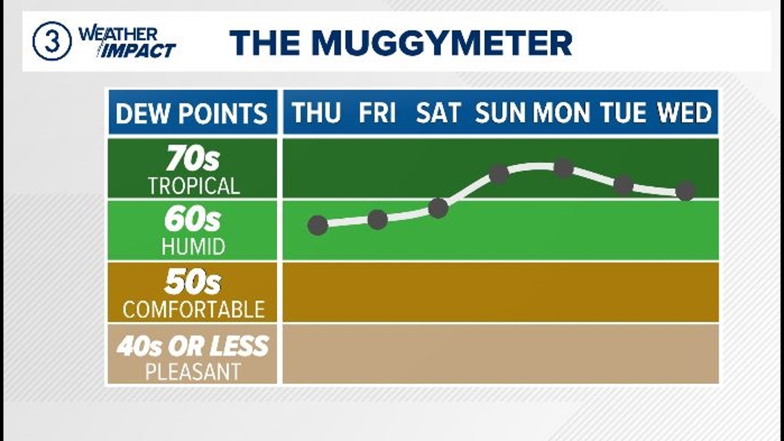
This period of intense heat is concerning due to the exceptionally high level of humidity. The humidity levels are predicted to climb to the mid-70s in terms of dewpoints, reaching a level typically associated with tropical climates. When coupled with expected daytime temperatures ranging from the low to mid-90s, the combination of heat and humidity will create a heat index that could make it feel like it’s between 105 to 110 degrees, which is a serious concern.

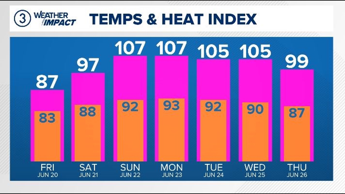
Moreover, there will be no respite from the oppressive heat even during the nighttime hours. Overnight temperatures are projected to linger in the mid to upper 70s throughout this period, with heat indices in the 80s persisting throughout the night.
Make sure you find ways to stay cool during this stretch — whether it be the pool, the library or other air-conditioned locations.
It’s important that you take this heat seriously.
RELATED: City of Akron to activate cooling center as heat wave approaches Northeast Ohio