
ORLANDO, Fla. – It’s time to dig out those raincoats and heavier jackets this week as a new cold front approaches the Sunshine State.
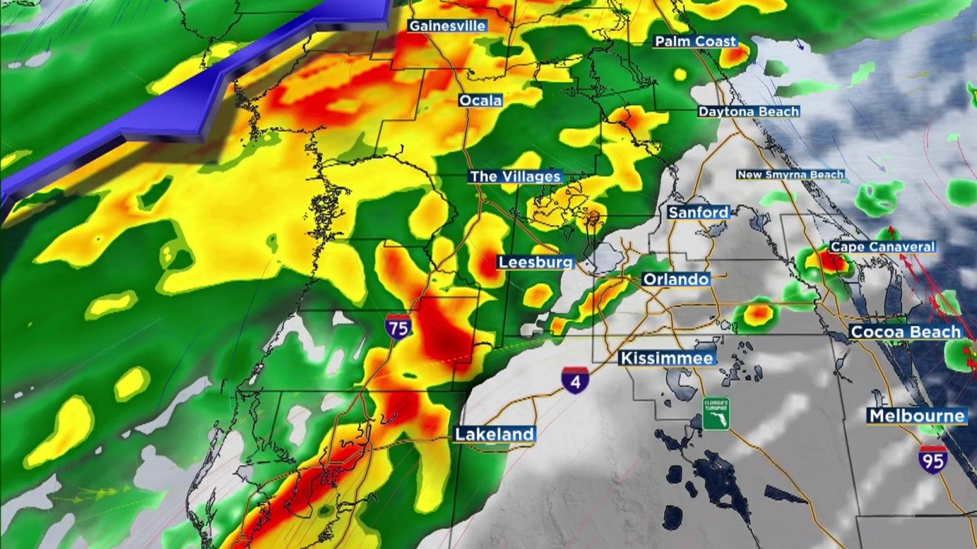
A wet Wednesday is expected in Central Florida as a strong cold front is approaching the region. Rain chances will rise in the afternoon and evening as a wave linked to a low-pressure system moves across the peninsula, pulling a cold front with it.
Wednesday will see gusty southwest winds of 10-15 mph and some breaks in cloud cover, allowing temperatures to reach the low to mid-80s in areas around Orlando and southward. Conversely, areas north of Orlando are likely to remain in the 70s due to increased cloud cover.
Anticipate a broad band of rain, possibly accompanied by a few isolated thunderstorms, to arrive in northern counties and the I-4 corridor by mid to late afternoon. This rain will progress east-southeast across the area, weakening as it moves southward. While the potential for thunderstorms is low, there is a high chance (60-80%) of heavy rain in the forecast.
As the front moves through, cooler and drier air will settle in, with rain chances diminishing overnight. By Thursday morning, temperatures will cool into the 50s across much of the area.
Looking ahead to Thursday and Friday, expect dry conditions with below-normal temperatures as northerly winds continue. Highs on Thursday will only reach the mid to upper 60s from Osceola/Brevard northward and the low 70s in Brevard.
Thursday night will be the coldest of the week, with lows in the mid to upper 30s northwest of I-4 and in the 40s along and south of I-4. Northerly winds will make it feel even colder, with wind chills in the 30s to low 40s early Friday morning, and possibly as low as the upper 20s in northern Lake and northwest Volusia counties.
A freeze watch is already in effect for central and western Marion County through Friday morning.
Friday will be even cooler, with highs in the upper 50s across northern Lake and Volusia counties. Daytona Beach might even come close to a record cool high for the day. Farther south, highs will be in the 60s.
As we head into the weekend, high pressure building offshore will lead to onshore flow and a slight increase in temperatures. However, highs on Saturday and Sunday will still be a bit below normal, ranging from the upper 60s along the Volusia County coast to the 70s farther south and inland.
Saturday looks mostly dry, but rain chances increase slightly on Sunday, up to 30%, with a passing trough aloft.
Copyright 2025 by WKMG ClickOrlando – All rights reserved.