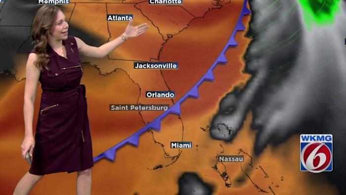
ORLANDO, Fla. – After a foggy start to the work week, expect partly cloudy skies and warmer-than-normal temperatures to close out 2024.
Last days of 2024
Although the weather is predicted to remain mostly dry, there is a possibility of a few isolated showers over the Atlantic waters or a stray shower across the peninsula. This weather pattern is expected to persist until Tuesday, with daytime temperatures reaching the mid to upper 70s and nighttime temperatures ranging from the upper 50s to mid-60s.
A new “colder” front is anticipated to move through Central Florida by Tuesday night and early Wednesday morning. This front is not expected to bring much precipitation, only some cloud cover along the boundary during New Year’s Eve celebrations.
By the time the clock strikes midnight, temperatures will remain in the mid to low 50s under mostly cloudy skies.
Starting 2025
As we head into the rest of the week and the weekend, high pressure will dominate the area, resulting in dry conditions. There is no significant rainfall expected at least until Sunday, with the weather remaining stable.
Besides less clouds around, the most noticeable change will be cooler temperatures dropping into the mid 60s to upper 60s after the front moves through. Overnight lows will dip into the upper 30s to upper 40s, and wind chill values will mostly be in the 40s, but some areas may feel like the mid to upper 30s.
Very cold outlook
Hopefully, you got some sweaters this past holiday as you will be needing them for a big stretch of January!
A big dip in the Jetstream that sets up as we start 2025 will remain in place for more than a week! Long range models are showing some of the coldest air in years for Central Floridians by the second weekend of January, with temperatures plunging between 20-25 degrees colder than average. Stay tuned as we continue to hone down on the detailed data as we get closer.
Copyright 2024 by WKMG ClickOrlando – All rights reserved.


