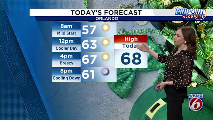


ORLANDO, Fla. – Central Florida can expect cooler and drier air on St. Patrick’s Day, with temperatures remaining significantly below average throughout the afternoon.
Expect breezy, gusty winds to keep temperatures in the upper 60s to near 70 degrees.
The dry and breezy conditions will heighten the fire risk in the region, leading to the issuance of a Fire Weather Warning until 8 p.m. on Monday for most areas in Central Florida.
Monday night is going to feel chilly, with lows in the mid to upper 40s inland and low 50s near the coast.
The northwest breeze will stick around, making it feel like the 40s, even if you’re bundled up!
As high pressure moves in, Tuesday will bring breezy conditions with north winds of 15-20 mph along the coast and 10-15 mph further inland. Though afternoon temperatures will increase slightly, reaching the mid-70s inland, coastal areas will remain cooler due to the brisk north winds blowing in from the water.
Tuesday night will be chilly again but without the strong winds. Wednesday looks even warmer with east-to-southeast winds around 10 mph, bringing temps up to the low 80s inland and upper 70s along the coast.
The high pressure starts to weaken Thursday, leading to a warm-up with temps hitting the low to mid-80s across the area. This warm-up lines up with the official start of Spring, which officially begins at 5:01 a.m.
The cold front is still on track to move through late Thursday, but it looks like we’ll stay dry.
After the front passes, temperatures will dip back into the 60s and 70s for a brief cool-down, then we’ll return to seasonable spring temps by the weekend.
Copyright 2025 by WKMG ClickOrlando – All rights reserved.