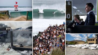
Over 4 million individuals have been alerted about the storm anticipated to hit either on Friday night or Saturday morning. It is predicted to bring heavy rainfall, strong winds, and the risk of flash floods.
Here’s everything you need to know about when and where Cyclone Alfred is predicted to strike.
When will Cyclone Alfred make landfall?
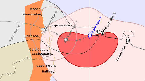
Alfred decelerated to 7km/h on Wednesday night and maintained this pace during Thursday, executing two unexpected loops off the shore. This altered the initial forecasts regarding its expected time of reaching land and the severity of its impact.
Damaging wind gusts up to 120km/h began lashing the coast between Moreton Island and Byron Bay on Thursday evening.
Destructive wind gusts, reaching speeds of up to 155km/h, were forecasted to affect the coastal regions and islands located south of the cyclone’s trajectory on Friday as a prelude to its landfall.
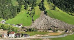
Heavy rainfall is expected after the cyclone crosses the coast and deteriorates into a tropical low, with possible daily totals of 350 to 450 millimetres, which could cause flash flooding.
How is the cyclone tracking?
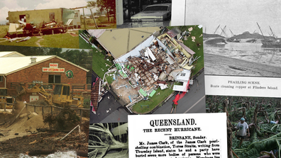
How Cyclone Alfred compares to Australia’s most destructive cyclones
Where is Cyclone Alfred likely to hit?
Cyclone Alfred is expected to affect the south-east Queensland coast and some parts of north-east NSW.
On Friday morning, the Bureau of Meteorology predicted the storm will cross the coast near Moreton Bay between Noosa and Coolangatta.
Residents living between the Sunshine and Gold coasts, particularly Brisbane, are forecast to be in the firing line.
The Bureau of Meteorology currently lists the areas from Double Island Point to Grafton as warning zones, including Brisbane, the Gold Coast, Sunshine Coast, and Byron Bay.
The warning zone does not include Grafton.
The northern NSW towns of Ballina and Lismore are also preparing for the cyclone.
However, the effects of the cyclone – especially strong winds – may extend beyond the currently listed regions.
In Pictures: Cyclone Alfred spotted from space as it approaches Queensland coast
What time will Cyclone Alfred hit Brisbane?
Cyclone Alfred is currently predicted to hit Brisbane on Friday night or Saturday morning, bringing damaging winds, intense rain and possible flooding.
How far is Cyclone Alfred from Brisbane?
At 4am on Friday, Alfred was 195 kilometres east of Brisbane and heading west slowly.
Wind gusts near the centre were hitting up to 130km/h and it was listed as a category 2 storm and expected to remain that way until making landfall.
The weather bureau will continue tracking the storm as it creeps closer to the coast.