Britain is still being battered by 75mph gales and heavy rain after Storm Eowyn wreaked havoc across the country.
A Met Office map has displayed three days of weather warnings and predicted up to four inches of snow in parts of Northern Ireland and Scotland.
The country is currently being battered by strong winds and heavy rain as the remnants of Storm Eowyn make their way across the UK. Tragically, a 20-year-old man lost his life when a tree collapsed on him while he was speaking to his father.
Today started ‘fine and dry’ with a ‘decent amount of sunshine’ in many parts of the country.
But a new low-pressure system is moving in from the south west bringing further strong winds and heavy rain.
Spanish meteorologists have dubbed it Storm Herminia, as the European country will feel the strongest winds.
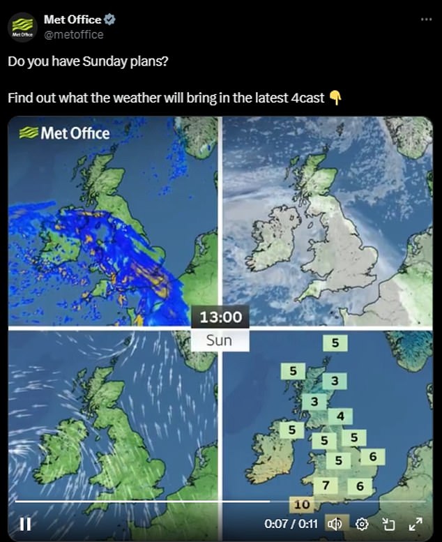
The storm is expected to impact the southern regions of England and Wales before progressing towards Northern Ireland and the north of England on Sunday afternoon. It is projected to reach parts of Scotland by the evening.

A bus shelter lies on its side and smashed up after the storm in Dechmont in West Lothian
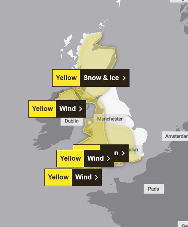
The yellow weather warnings in place for today on a Met Office map
Around 35,000 properties in Scotland were still without power on Saturday evening, a spokesperson for the Scottish Government said.
In the aftermath of what has been dubbed the ‘storm of the century,’ Scotland is facing a significant £500 million operation to clean up and repair the widespread damage and devastation caused by the weather.
Weather experts admitted that Storm Eowyn’s terrifying 100mph winds on Friday were more powerful than anything seen since the 1990s.
Yesterday, Northern Ireland Electricity Networks said 189,000 homes and businesses didn’t have electricity due to the damage and it is expected to take a few days to restore.
The Met Office has said Storm Eowyn is the strongest to hit the British Isles in at least 10 years.
Met Office meteorologist Jonathan Vautrey said: ‘This is certainly going to be a notch down compared to Eowyn, whilst there is the potential for 60 to 70mph gusts of wind across the very far south west generally, we’re not going to be seeing the same strengths of winds as we have seen over the last couple of days.’
However ‘there are a lot of sensitivities around’ following Eowyn, he said.
More than a million people in the UK were without power during the storm, and there was significant travel disruption across the UK and Ireland.
Ministers from across the UK held an emergency Cobra meeting on Saturday to co-ordinate recovery efforts, and extra engineers were dispatched from England to Northern Ireland and Scotland.
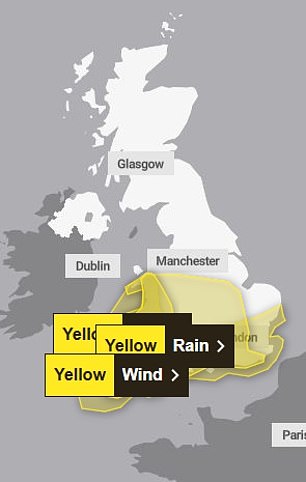
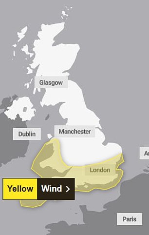
The yellow weather warnings are in place for the next two days
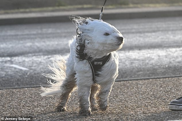
A dog struggling in Storm Eowyn as it hit Blackpool in Lancashire
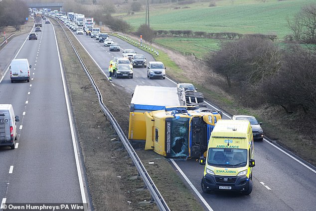
A crashed lorry on the A19 northbound near Seaham in County Durham in strong winds on January 24

A Nissan Micra car is demolished under a pile of bricks on Newcastle Road in Sunderlandon Thursday
‘Obviously places maybe currently have a bit of a lower threshold for wind strengths at this stage, following all the disruption and damage that’s been put in place’, Mr Vautrey said.
‘It is something that people certainly need to be wary of, and still taking care of, as we head into Sunday and into the start of the new working week as well - the risk of localised flooding, further flying debris and travel disruption is possible as a result of all of this.’
The low-pressure system will linger through Monday and Tuesday bringing outbreaks of rain, occasional heavy showers and blustery winds in places.
A yellow warning for wind is in place in the south-east, south-west and north-west England, as well as Wales and south-western parts of Scotland, from 8am to 3pm on Sunday.
Gusts of 50mph to 60mph are expected widely and they could reach 70mph on exposed coasts and hills, the Met Office said.
Another yellow warning for ‘strong and gusty winds’ will be active from Monday at 6am until the same time on Tuesday in the east, south-east and south-west of England and Wales.
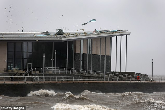
Helensburgh swimming pool roof is ripped apart as Storm Eowyn hit Scotland on Friday
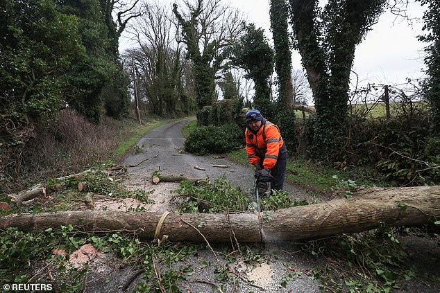
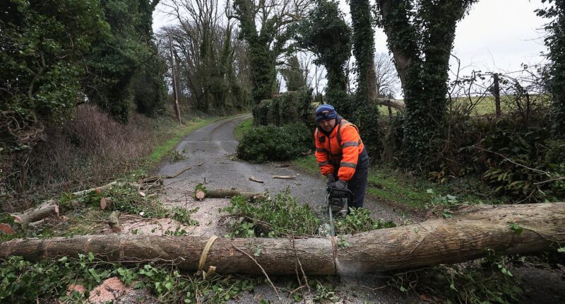
A man uses a chainsaw as he works on removing a tree which fell in Kilteel county Kildare, Irelandon Friday

A tree which fell into a house and garden on Cyprus Avenue in east Belfast on Friday
Most of central and southern England and much of Wales have a yellow warning for heavy rain in place from 8am on Sunday to 6am on Monday, bringing a chance of local flooding for parts of the UK.
The Met Office warned 10 to 20mm of rain will fall, nearing 30 to 50mm on high ground.
A further heavy spell on Sunday evening could bring as much as 80mm.
‘Given recent heavy rain, this extra rainfall could lead to some local surface water and river flooding’, the Met Office said.
The West Midlands and most of Wales have a yellow heavy rain warning between 6am and 11.59pm on Monday.
The Met Office said yet another low-pressure front will pick up on Wednesday and again arrive in the south-west.
Mr Vautrey said: ‘South-western areas certainly bearing the brunt this time in terms of the most unsettled conditions.
‘The first half of next week, still pretty unsettled.’
There are tentative signs of calmer weather for much of the UK next weekend, he added.
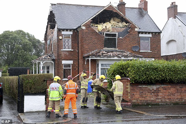
Firemen secure a house in Belfast that was damaged by the winds of Storm Eowyn on Friday
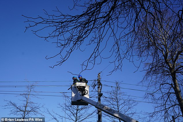
Networks crew working to restore power in Avoca Avenue in Blackrock, co Dublin

Scotland was issued with a rare red weather warning yesterday, with workers clearing the storm’s debris
Storm Eowyn has been ‘somewhat extraordinary’, the meteorologist said.
Multiple weather systems are arriving at the same time because of the placement of the jet stream, he added.
‘It’s being fuelled by the cold wave that they’ve had recently over the United States and Canada, and that contrast between the cold air there, and the mild air pushing in from the equator is helping to fuel this very powerful jet stream across the Atlantic at the moment.
‘It’s the exact positioning of the jet stream that determines who sees the low pressure and who sees the strongest winds.
‘Initially it helped steer Eowyn up towards the north west of the UK, and so we saw the strongest winds from that (there).
‘Whereas with this next system that the Spanish have named, because the jet stream is just slightly further south now, it’s pushing it a little bit more to the south of the UK, but into parts of continental Europe as well - that’s why they’re seeing the strongest winds’.
An Emergency Cobra meeting was held over Storm Eowyn following Met Office claims that it was the strongest weather bomb to hit the UK in 10 years.
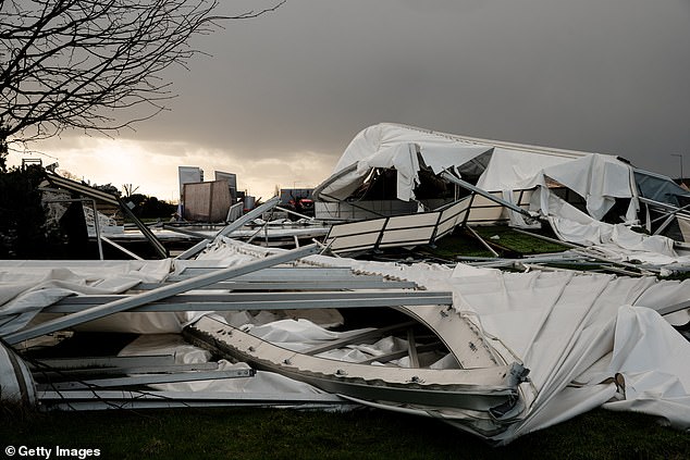
Ice skating rink collapse during the storm Eowyn in Blanchardstown, suburb of Dublin

A shopper struggles to hold an umbrella due to strong wind as Storm Eowyn hit in Edinburgh
The Chancellor of the Duchy of Lancaster, Pat McFadden, chaired a meeting with ministers to discuss the response to the storm, including work to reconnect homes without power.
Deputy Prime Minister Angela Rayner, the Secretaries of State for Northern Ireland and Scotland, the First Ministers of Northern Ireland and Scotland and the Deputy First Minister of Northern Ireland also attended the meeting.
A government spokesperson said: ‘The Chancellor of the Duchy of Lancaster Pat McFadden chaired a Ministerial COBR meeting with the Deputy Prime Minister, the Secretaries of State for Northern Ireland Office and Scotland Office, ministers from across government, the First Minister and Deputy First Minister of Northern Ireland and the First Minister of Scotland.
‘Ministers discussed the ongoing response to Storm Eowyn, particularly the urgent work underway to reconnect homes which have lost power.
‘To support recovery, engineers have been dispatched to Northern Ireland and Scotland, and Ministers thanked all front-line workers for their efforts to keep communities safe.
‘We continue to monitor the situation and stand ready to provide further support, working closely with the Scottish Government and Northern Ireland Executive.’
Areas of Scotland and Ireland have already seen devastating damage, with buildings ripped apart, trees torn from their roots and tearing winds laying waste to their streets.
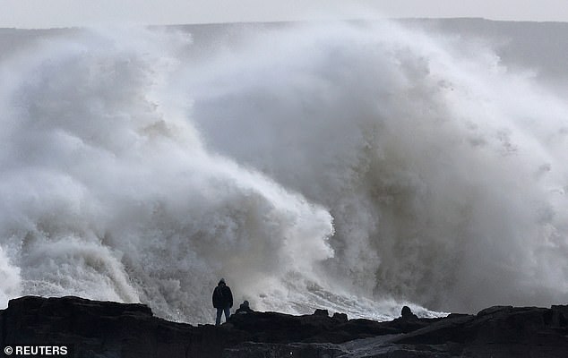
People view large waves as Storm Eowyn arrives at Porthcawl in Wales on Friday
Train services are not expected to recover until next week such was the destruction on the railways, with over 120 trees falling on the tracks.
Network Rail reported 400 individual incidents across the network. These included multiple trees on tracks, damaged overhead wires, power supply failures, plus other objects on the line.
ScotRail said they managed to reopen some lines, including Perth- Inverness, Inverness - Elgin, Inverness - Aberdeen, Dundee - Aberdeen, Perth - Dundee, Edinburgh - Tweedbank, Edinburgh - Dunbar, and Drem - Edinburgh.
ScotRail said that ‘significant disruption will continue for the rest of Saturday and into Sunday.
A gust of 100mph was recorded at Drumalbin in South Lanarkshire in Scotland on Friday, the Met Office said, while a record-breaking wind speed of 183kmh (114mph) was measured in Mace Head, Co Galway in Ireland, Met Eireann said.
A 96mph wind was measured at Brizlee Wood in Northumberland, while it was 93mph at Aberdaron in Gwynedd, Wales, and 92mph at Killowen in County Down, Northern Ireland.
Some 20 per cent of all flights scheduled to or from UK or Irish airports were cancelled, according to aviation analytics firm Cirium which said a total of 1,070 had been cancelled - with Dublin, Edinburgh, Heathrow and Glasgow worst affected.
Hundreds of passengers also spent hours on flights which returned to their points of departure after being unable to land at their planned destinations.
Hundreds of schools closed in Scotland, Wales and northern England during the storm - while 715,000 homes, farms and businesses were without power across the Republic of Ireland, and a further 240,000 homes and business in Northern Ireland suffered cuts.
The Isle of Man’s Department of Infrastructure declared a major incident because of the number of fallen trees and their impact on arterial roads and emergency services.
