
The countdown is on for the start of the 2025 Atlantic Hurricane season, which begins on June 1 and lasts through the end of November.
In 2024, the Gulf Coast experienced a remarkable season, highlighted by the landfall of Hurricane Beryl in southeast Texas. ABC13 Meteorologist Elyse Smith presents a preview of what to anticipate for the upcoming year.
One of the significant factors to consider is El Niño or La Niña. It is highly probable that this hurricane season will fall under ENSO neutral conditions, often referred to as “La Nada.” This implies that the Trade Winds in the Atlantic are positioned as usual with normal strength, without any substantial impact on jet stream patterns or ocean temperatures commonly associated with El Niño or La Niña. Ocean temperatures remain a key influencer, with warmer waters increasing the chances of storm formation and intensification.
The development of storms can be influenced by the status of the West African Monsoon, which brings clusters of thunderstorms into the Atlantic, potentially leading to tropical systems. The presence of Saharan Dust, particularly early in the season, can inhibit this process. Therefore, when assessing the threat of storms to southeast Texas, local weather patterns and conditions in the Caribbean play a crucial role. For instance, the positioning of the jet stream over the Gulf can result in increased wind shear, which has the capability to weaken tropical systems.
That said, the 2025 Atlantic hurricane season could be an active one with above-normal activity across the tropics. While the 2025 outlook from NOAA is set to be released this Thursday, researchers with Colorado State University released theirs last month. It also reflects the above normal prediction, calling for 17 tropical storms, nine becoming hurricanes, and four potential major hurricanes.
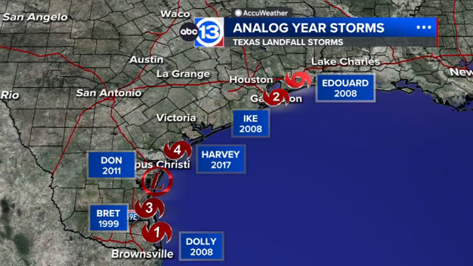
Another way to preview an upcoming hurricane season is through analog years. These are past years which, based on similar atmospheric conditions, could be comparable to what this season might look like. Dr. Phil Klotzbach with Colorado State University told ABC13 Meteorologist Elyse Smith that these years are 1996, 1999, 2006, 2008, 2011, and 2017.
Some of these years will stand out to Texans, and for good reason: 2008 for Hurricane Ike and 2017 for Harvey. However, consider 2006 and 1999, which were very different seasons for the Texas coast. 2006 was a slightly below normal year in terms of the number of storms, and no hurricanes made landfall in the U.S. Tropical storms did hit Florida that year. 2011 was active for the Atlantic and Bay of Campeche, but not necessarily the Gulf.
One thing worth mentioning, we don’t know how the recent cuts to NOAA will impact operations during hurricane season. While outlooks and forecasts will still be issued in a timely and accurate manner, one curveball could be associated with the hurricane hunters, the possibility of or frequency of their flights, and any research planned to occur during this hurricane season.
For more on this story, follow Elyse Smith on Facebook, X and Instagram.
Copyright © 2025 KTRK-TV. All Rights Reserved.