
The threat of a tropical cyclone hammering multiple Southeast states during the Fourth of July weekend has increased.
The likelihood of a significant weather disturbance forming directly over Florida has been increased to 30 percent by the National Hurricane Center (NHC) for this upcoming weekend. This indicates a 10 percent rise from the forecast provided on Monday.
The potential storm threatens to rip through parts of Florida, Georgia, Alabama, Mississippi, and the Carolinas.
That puts more than 39 million people in its path, not including the millions who typically travel to popular destinations in the Southeast.
Experts at AccuWeather have cautioned that if this tropical development occurs, it could persist from July 4 to July 7. This situation may result in heavy rainfall, potentially impacting the entire 4th of July holiday weekend and causing disruptions to travel in the area.
Alex DaSilva, the leading hurricane specialist at AccuWeather, mentioned that there is a probability of a stationary front settling in the Southeast for several days. This situation has the potential to trigger the formation of a tropical disturbance.
‘These types of storms are typically on the weaker side, but they can produce a lot of rain that can trigger flooding problems,’ DaSilva added.
A record 72.2 million people in the US are expected to travel during the Fourth of July holiday period (from June 28 to July 6), surpassing even pre-pandemic travel numbers.

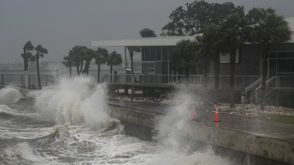
Forecasters have raised the odds of a tropical cyclone forming in the Southeast over Fourth of July weekend to 30 percent (Stock image)

Meteorologists with AccuWeather believe the track of the storm will take it through Alabama, Mississippi, Florida, Georgia, and the Carolinas. That could affect more than 30 million people and countless holiday travelers
In terms of what this could mean for Fourth of July fireworks, AccuWeather has already downgraded the chances of viewing fireworks in Florida to ‘poor.’
Meteorologists also expect tropical downpours throughout the entire state during the holiday weekend, starting on Thursday and lasting through Sunday.
This includes flash flooding, thunderstorms, and rough surf along the coast for beachgoers who brave the storm.
In Georgia, North Carolina, and South Carolina, the chances of seeing fireworks along the coastline are currently rated as ‘fair,’ but that could change quickly if a tropical cyclone does end up forming at the end of the week.
A tropical cyclone forms over warm oceans, typically with sea surface temperatures above 80°F.
They have a well-defined, warm core, and organized convection – the engine of a tropical cyclone that converts ocean heat into the storm’s power, rainfall, and winds.
In stronger storms, a convection that fuels intense thunderstorms can potentially turn into the eye of a hurricane.
At the moment, DaSilva projected that the cyclone will likely form right on the Fourth of July, meaning millions of travelers will already be in the path of the tropical storm if it arrives.

Forecasters are predicting severe thunderstorms, flash floods, and prolonged downpours throughout Florida starting on July 3 (Stock image)

The entire state of Florida is expected to be hit by the potential storm, bringing rough surf to beaches, which are already expected record crowds this Fourth of July
Severe storms during this holiday week have already disrupted travel along the East Coast.
On Monday, thunderstorms from Houston to New York grounded thousands of flights at multiple airports, including New York’s John F Kennedy International and Philadelphia International Airport.
Even more travel disruptions are expected on Tuesday, with more thunderstorms predicted to ground flights in Pennsylvania and Virginia.
AccuWeather Senior Meteorologist Alex Sosnowski said: ‘Because of the cluster of major airport hubs in the mid-Atlantic, those with flights in, out, or connecting through the region may run into delays and cancellations as storms pass through during the afternoon and evening on Tuesday.’
On Monday, those travel delays dragged on for hours as flyers had to wait out the storms. In New York, travelers at JFK, LaGuardia, and Newark Liberty Airport were forced to wait for more than two hours as delays backed up into the night.
Severe thunderstorms are expected to flare up in the South and spread to parts of the Midwest and Northeast as holiday travel peaks this week.
Cities including Atlanta, Tallahassee, Washington DC, and New York could see more flight delays or cancellations due to the stormy weather.
Thunderstorms could intensify along the Interstate 95 corridor from Tuesday into Wednesday, impacting many of the 61 million Americans planning to drive over the holiday weekend.
As meteorologists continue to track this potential tropical cyclone, the forecast for the rest of summer is not looking very promising.
The National Oceanic and Atmospheric Administration (NOAA) revealed in May that they are predicting an ‘above average’ hurricane season that will likely result in more named storms than there were in 2024, when 18 such storms were tracked.
Overall, NOAA is predicting up to 19 named storms, 10 hurricanes, and five major hurricanes affecting the US this year.
The NHC noted that approximately 400 people died during 2024’s hurricane season, the deadliest season since 2005.
The Fourth of July cyclone is not expected to become a named storm. The NHC only assigns names to storms once they reach tropical storm status with sustained winds of at least 39 mph.
If it intensifies, however, it will be named Chantal, following Tropical Storm Barry, which made landfall in Veracruz, Mexico on June 29 before weakening.