
CHICAGO (WLS) — A round of severe storms are expected to move into the Chicago area Friday night, with strong winds continuing onto Saturday during St. Patrick’s Day celebrations.
Friday is forecast to be very warm with highs well into the 70s and potentially as high as 80 with wind gusts up to 45 miles-per-hour, ABC7 Accuweather Meteorologist Tracy Butler said.
ABC7 Chicago is now streaming 24/7. Click here to watch
Butler says the severe storms will start moving into the area around 10 p.m. and move out around 3 a.m.
The storms are expected to move rapidly and are expected to be more severe further south.
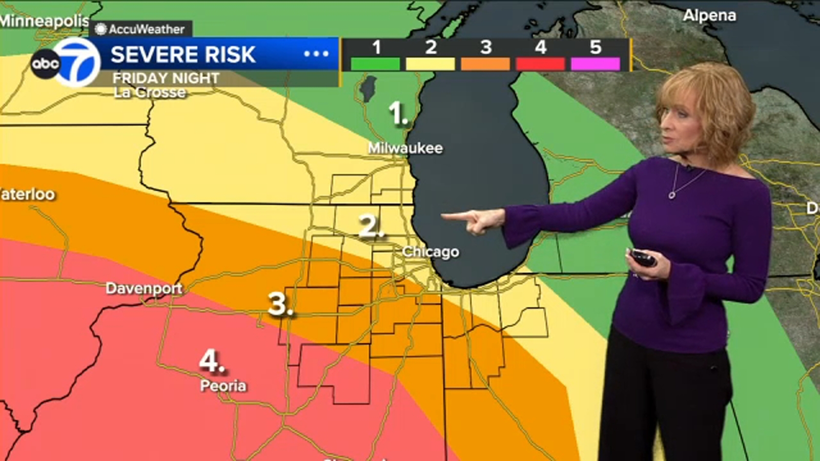
The Storm Prediction Center has Chicago and northern suburbs at a Level 2 risk for severe storms, with Will County and some southern suburbs at a Level 3 risk and a Level 4 risk for areas further downstate.
The National Weather Service has issued a Wind Advisory, which will go into effect at 4 p.m. and remain in effect until 4 a.m. Saturday.
A High Wind Watch will go into effect for the Chicago area Saturday at 8 a.m. and remain in effect until 2 p.m.
Saturday’s forecast calls for highs in the 60s with wind gusts up between 50-60 mph.
Sunday will be much colder, with a high around 40.
Cook County Radar | DuPage County Radar | Will County Radar | Lake County Radar (IL) | Kane County Radar | Northwest Indiana Radar
Copyright © 2025 WLS-TV. All Rights Reserved.